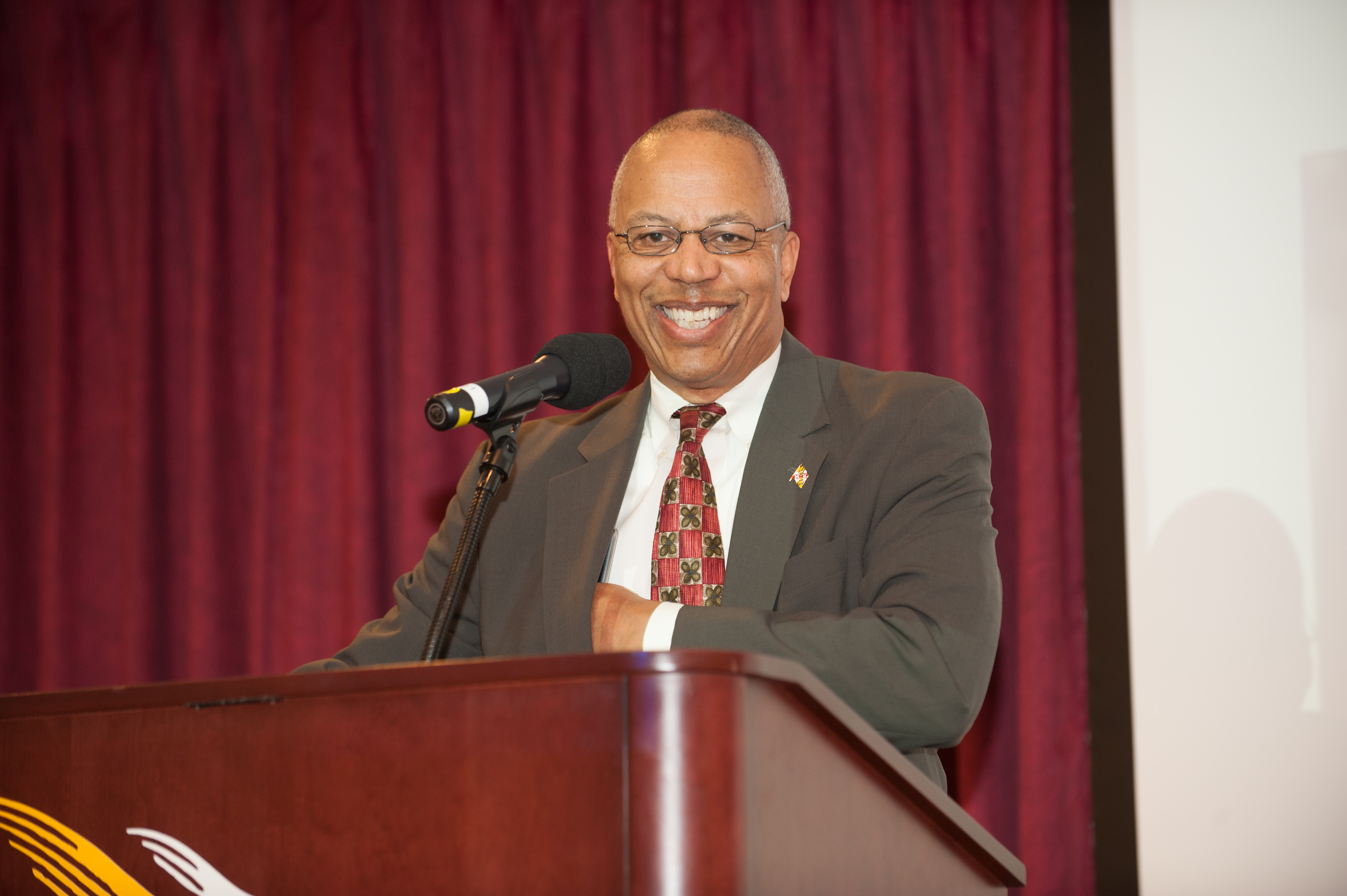
Maryland Lt. Gov. Boyd Rutherford gave the opening remarks at Tuesday’s TUgis Conference.
Maryland Lieutenant Governor Boyd Rutherford joined more than 600 professionals, innovators and students at Tuesday’s TUgis Conference for an energetic exchange on technology most people use every day without knowing it exists: geographic information systems.
Geographic information systems, or GIS, are computer-based technologies that collect, manage, analyze and display information through interactive maps. Smartphone GPS navigation is a good example of everyday GIS at work. GIS and related systems can also be used to map broadband coverage, direct first responders in emergencies, identify opportunities for economic development, manage infrastructure, and even help the environment. The lieutenant governor has an active role in managing StateStat, Maryland’s system of gauging state government efficiency. GIS technology plays a role in those assessments by mapping things like how and where budget funding is allocated and spent.
“I am delighted to welcome the lieutenant governor to campus to get a sense of who we are and how we contribute to GIS in Maryland,” said Interim President Timothy J. L. Chandler. “We’ve been hosting this event for more than 20 years, and we’re always pleased to work with so many GIS professionals to make Maryland highly competitive in infrastructure management, environmental protection and economic development.”
The TUgis Conference, hosted by the Department of Geography and Environmental Planning and the College of Liberal Arts, helps build and foster relationships in the GIS community while highlighting advances and giving students a chance to talk with people who work in the field. Towson University offers a GIS minor in the College of Liberal Arts.
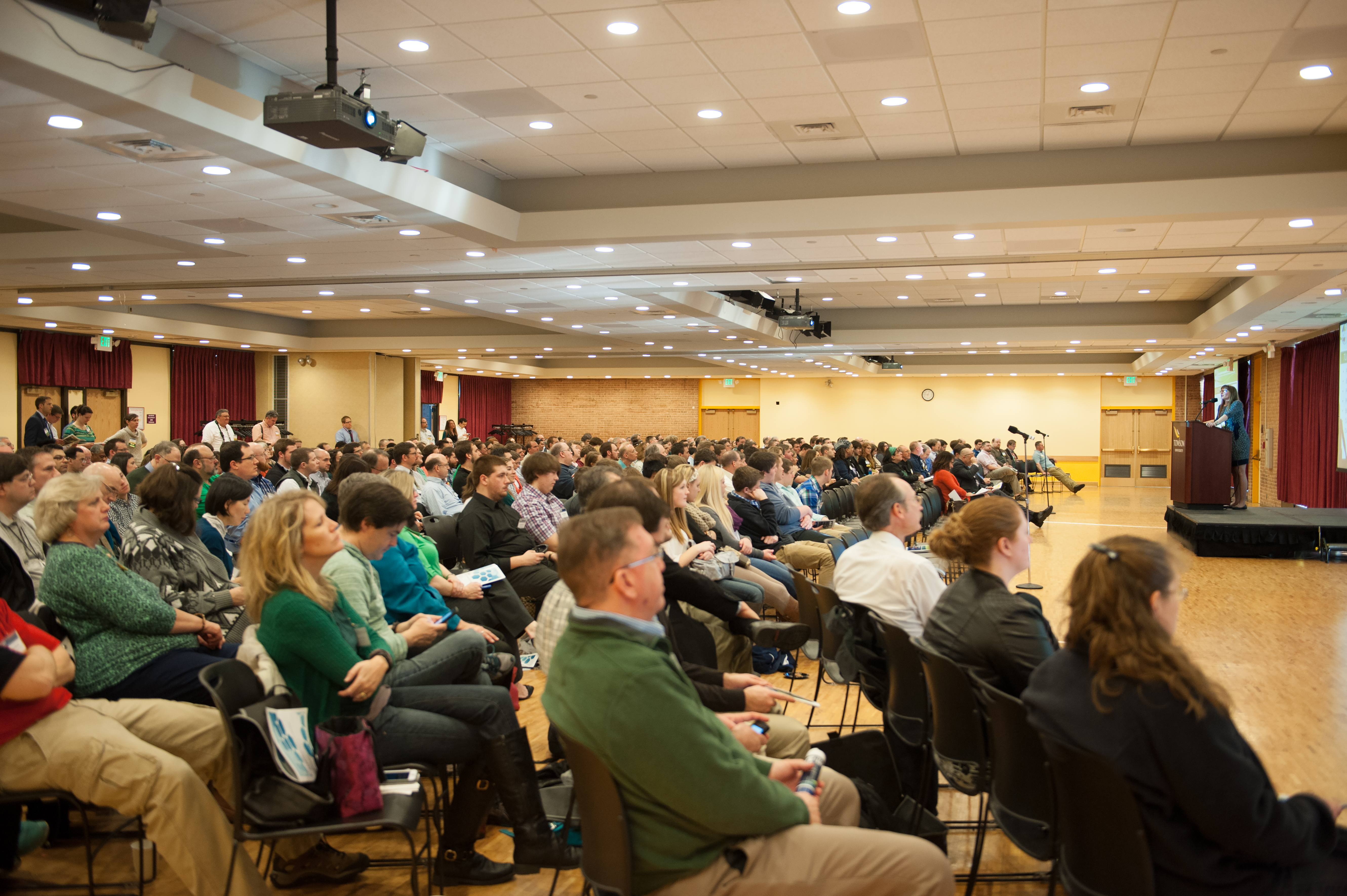
More than 500 GIS and GIS-related professionals, as well as students, attended Tuesday’s conference.
The event, which saw its highest attendance in 10 years, brought together more than 140 presenters and 33 leading geospacial companies, nonprofits, and educational institutions, including TU’s Center for GIS. The day provided discussions, presentations, and networking opportunities.
“The Department of Geography and Environmental Planning, with the leadership of Virginia Thompson, continues to do a remarkable job each year of sustaining the TUgis conference and bringing together a large and lively group,” said College of Liberal Arts Dean Terry Cooney. “The Cheasapeake Rooms were bursting at the seams, and the Liberal Arts building was buzzing with talk throughout the day in sessions, around vendors’ tables, and along the hallways.”
A popular feature of the conference each year is the Map-App Competition. This year’s competition included 12 app entries and 17 map entries. Liz Holtz, a TU undergraduate student, was named a winner in the map portion of the competition.
TUgis is presented in cooperation with the Maryland State Geographic Information Committee and the Maryland Department of Information Technology.
Related links:
TUgis photo gallery